Atlas Containing Ten Maps of Poland   1837   J. Bansemer & P. Zaleski


From the:  Atlas Containing Ten Maps of Poland Exibiting the Political Changes That Country Has Experienced

During the Last Sixty Years, From 1772 to the Present Time, by Jan Marcin Bansemer & Piotr Falkenhagen Zaleski, 1837.

Courtesy of Biblioteka Jagiellonska, Krakow.


Poland in 1772 with its Principal Geographical Divisions


Full file view (download)

Poland in 1772 after the First Partition


Full file view (download)

Poland in 1793 after the Second Partition  


Full file view (download)

Poland in 1795 after the third Partition  


Full file view (download)

Poland in 1807 after the Treaty of Tilset


Full file view (download)

Poland in 1809 after the Treaty of Schonbrunn  


Full file view (download)

Poland in 1815 after the Congress of Vienna  


Full file view (download)

Poland in 1831 after the War of Independence


Full file view (download)


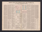
Geographical, Historical, Political, Chronological, Statistical, Literary and Commercial Table of Ancient and

Modern Poland 


Full file view (download)

Poland and the Neighboring Countries according to the Religion of the Majority  


Full file view (download)

Poland and the Neighboring Countries according to the Language of the Inhabitants


Full file view (download)