The Duchy of Warsaw
The Duchy of Warsaw (Polish: Księstwo Warszawskie, French: Duché de Varsovie, German: Herzogtum Warschau) was a Polish state established
by Napoleon I in 1807 from the Polish lands ceded by the Kingdom of Prussia under the terms of the Treaties of Tilsit. The duchy was held in personal
union by one of Napoleon's allies, King Frederick Augustus I of Saxony. Following Napoleon's failed invasion of Russia, the duchy was occupied by
Prussian and Russian troops until 1815, when it was formally partitioned between the two countries at the Congress of Vienna. It covered the central
and eastern part of present Poland and minor parts of present Lithuania and Belarus.
In 1809, a short war with Austria started. Although the Duchy of Warsaw won the Battle of Raszyn, Austrian troops entered Warsaw, but Duchy and
French forces then outflanked their enemy and captured Kraków, Lwów and some of the areas annexed by Austria in the Partitions of Poland. During
the war, the German colonists settled by Prussia during Partitions, openly rose up against the Polish government.[2] After the Battle of Wagram, the
ensuing Treaty of Schönbrunn allowed for a significant expansion of the Duchy's territory southwards absorbing the third Austrian partition known as
west Galicia, thus regaining once-Polish and Lithuanian lands.
Full article at Wikipedia here.
|
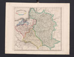
Poland in 1807 after the Treaty of Tilsit (1837) Jan Marcin Bansemer
More on the Treaty of Tilsit: http://www.napoleon-series.org/research/government/diplomatic/c_tilsit.html
Courtesy of the Biblioteka Jagiellonska Cracow |
 |
|
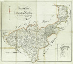
Generale-Charte-Herzogthume-Warschau (1808) Kunzel
Source: https://rcin.org.pl/dlibra/publication/2578/edition/290 |
 |
|
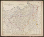
Generalkarte vom Konigreich Preussen und Herzogthum Warschau (1807) Sotzmann
Source: The National Library of Poland |
 |
|
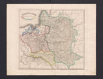
Poland in 1809 after the Treaty of Schonbrunn (1837) Jan Marcin Bansemer
Courtesy of the Biblioteka Jagiellonska Cracow |
 |
|
The Second Duchy of Warsaw 1809 (1831) A.H. Dufour, Leonard Chodzko From the: Atlas historique, politique et statistique de la Pologne ancienne et moderne indiquant ses divers demembremens et partages: dediee a Joachim Lelewel.
|
_of_Warsaw_1831_A.H._Dufour.jpg) |
|
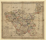
Mappa Xięstwa Warszawskiego : dziesięć departamentów podzielonych w sto powiatów (1811) Map of the Duchy of Warsaw: ten departments divided into 100 counties
|
 |
|
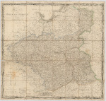
Karte vom Herzogthum Warschau (1812) F.B. Englehardt
Source: The National Library of Poland |
 |
